Pass computation
Elevation, azimuth, duration and maximum elevation for every compatible satellite over the AOI. Heavy propagation runs in a worker so the map never stutters.
Stages 01 – 03
Define the area, find the windows, place the order. Everything upstream of the image, from a polygon on a map to a confirmed acquisition with an operator.
01 · Define
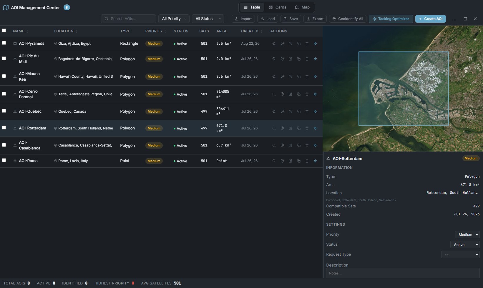
AOI Management Center · table view with per-area detail
02 · Plan
SGP4 propagation on TLEs refreshed twice a day from CelesTrak, over the satellites you selected, for the next seven days.
Elevation, azimuth, duration and maximum elevation for every compatible satellite over the AOI. Heavy propagation runs in a worker so the map never stutters.
Each window is scored on maximum elevation, forecast cloud cover, sun elevation and off-nadir angle — so the shortlist is ranked, not just listed.
Pick any observation point and get the next ten passes over seven days. Global opportunity windows are one click from the header.
Pass and coverage density rendered directly on the map, so gaps in your constellation selection are visible instead of implied.
Day/night overlay and solar angle, plus sensor swath corridors drawn as ground footprints.
Acquisition analytics, operator comparison, quality scoring, and a conflict engine that catches two orders competing for the same satellite window.
A real 3D scene, not a spinning globe for show — live SGP4 orbit traces for up to 20 satellites at once, AOI footprints that light up the instant a pass enters its actual computed window, driven by the same simulation clock as the 2D map.
Select a satellite and its ground track and real-time position appear on the map automatically, refreshed continuously off the main thread — not a one-off snapshot.
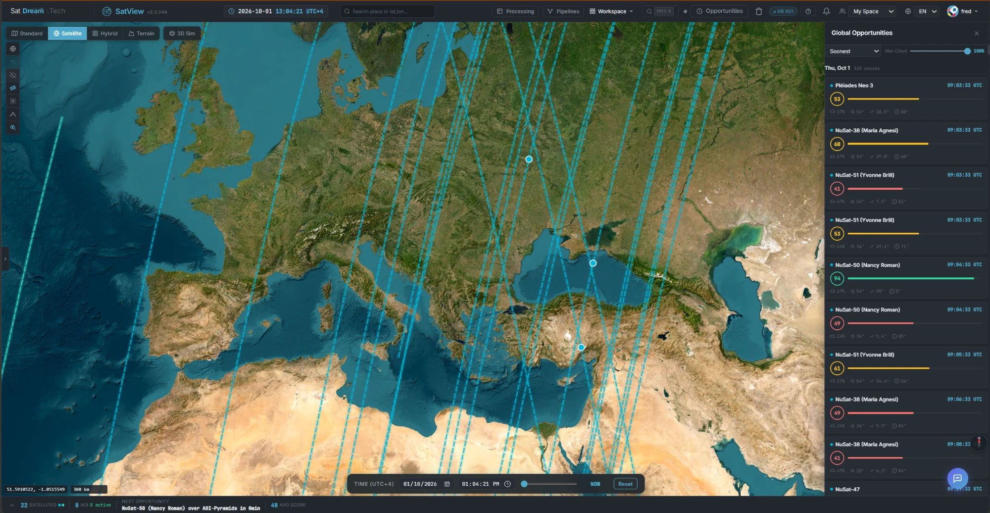
Global Opportunities · every pass, scored and ranked
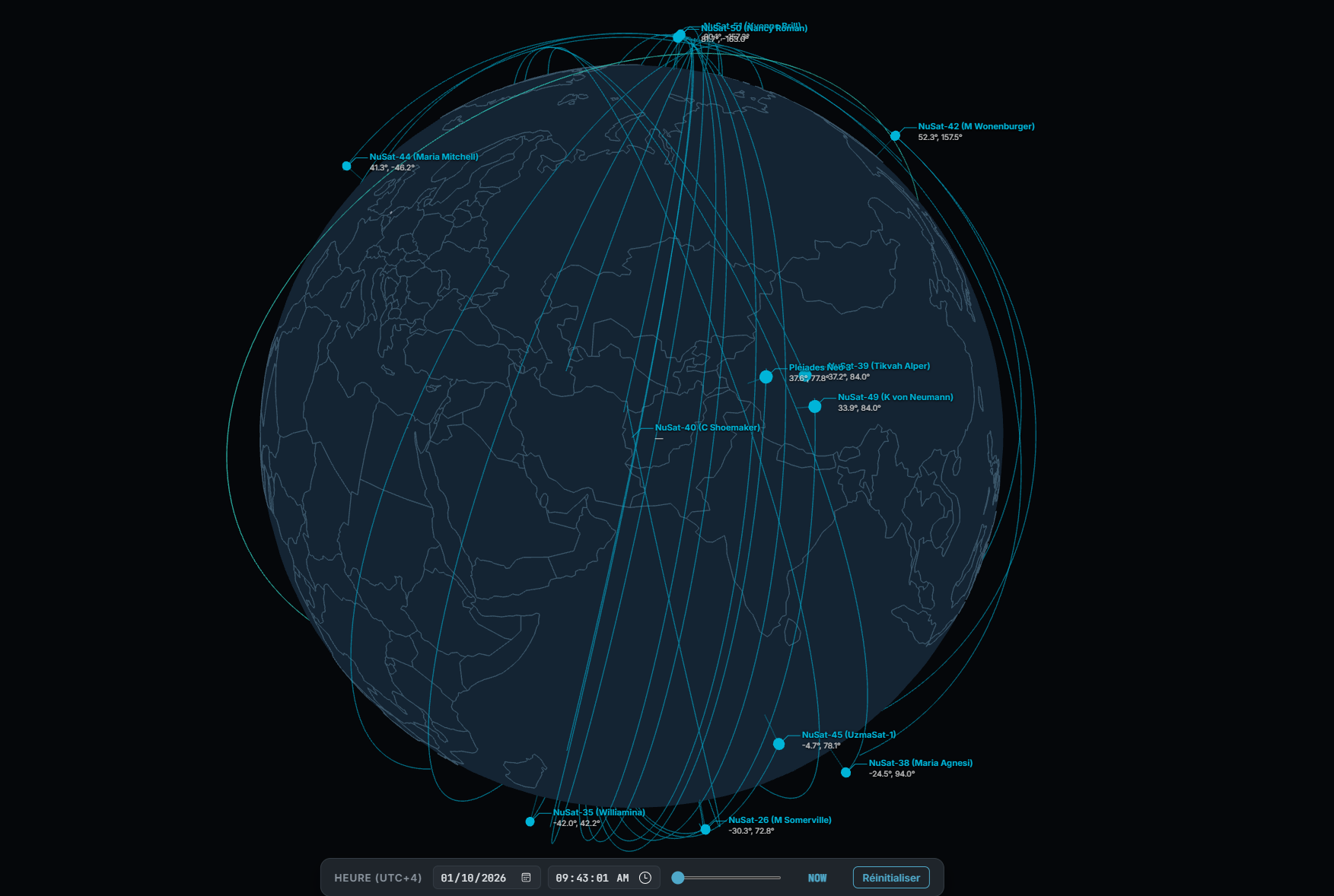
3D Sim · live orbit traces, shared simulation clock
03 · Order
Unified multi-provider search returns STAC Feature 1.0 across every connected catalog. Browse archives, build multi-source bundles combining several providers, and keep them in a STAC basket you can refresh or cancel.
Direct operator tasking for Planet, Capella, Maxar, Spire, Airbus OneAtlas and Satellogic. Submission, delivery download and status polling are handled inside SatView.
Multi-step, with a live cost estimator so budget is visible before confirmation.
Visual drag-and-drop planning against a running budget, plus a Tasking Optimizer that scores candidate bands across every AOI and satellite and proposes a minimum-coverage plan, weather conflicts flagged inline.
Open-Meteo forecasts feed straight into planning, so cloud risk is priced in at scheduling time.
Requests over embargoed countries are checked automatically before the order goes through, against the zone list your organization maintains.
Tracked in three views — timeline, kanban board and map — with a global Gantt across every AOI and satellite.
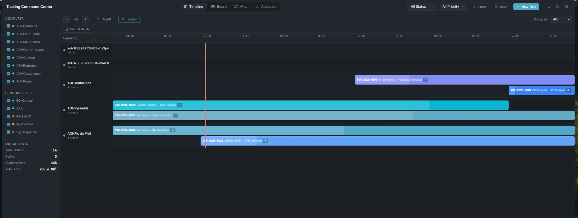
Tasking Command Center · Gantt timeline, grouped by AOI
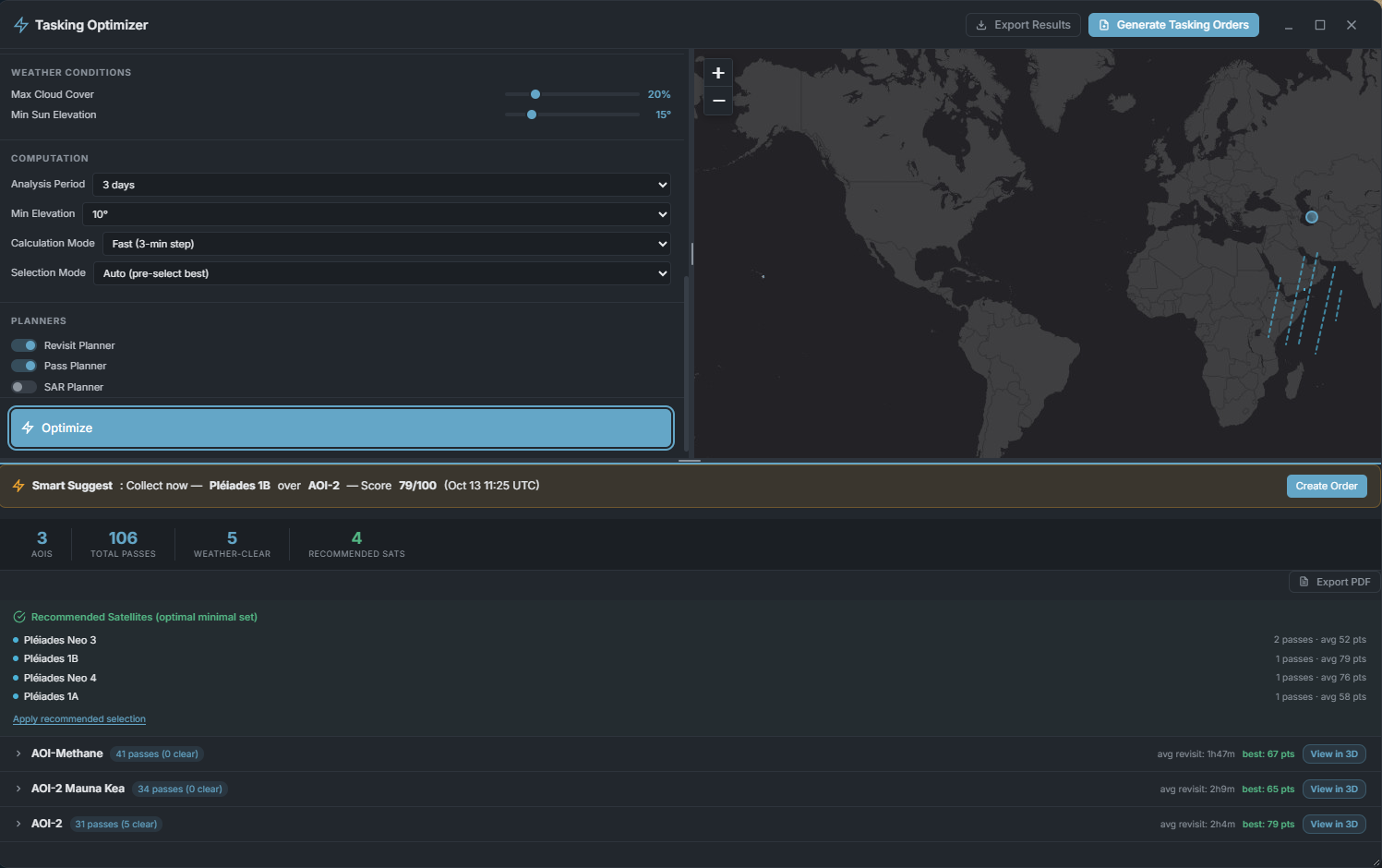
Tasking Optimizer · weather/computation settings, planners, and per-AOI results
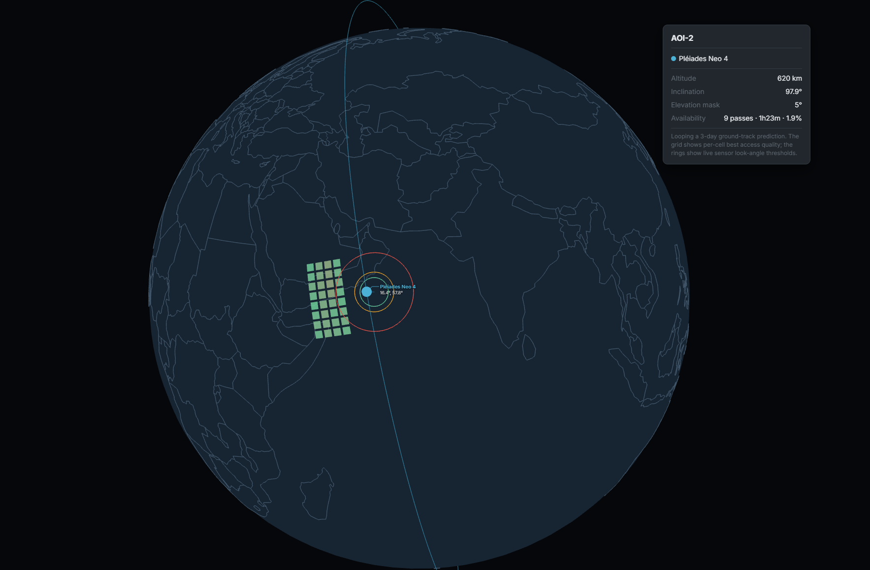
3-day access prediction · off-nadir rings and per-tile access quality, looping at 100×
Beyond one order
A mission ties together every AOI, every satellite and a whole date range, with its own lifecycle and a feasibility check before you commit a budget line.
Team-scoped, with a real lifecycle — Tentative, Scheduled, Ad-hoc, Active, Completed, Terminated, Archived — not just a flat list of orders.
Four steps — map, per-AOI revisit requirements, then a real feasibility pass (the same SGP4-based pass-finding and revisit-statistics engine behind the tasking optimizer, not a mockup), a budget summary, and an AI-generated plan advisory flagging risks and recommended satellites per AOI.
Every saved mission opens straight into 3D Sim, preloaded with its own satellites, AOIs and dates. Entering a pass window also shows a frozen "onboard camera" inset — real stitched imagery, not a live-rendered photo.
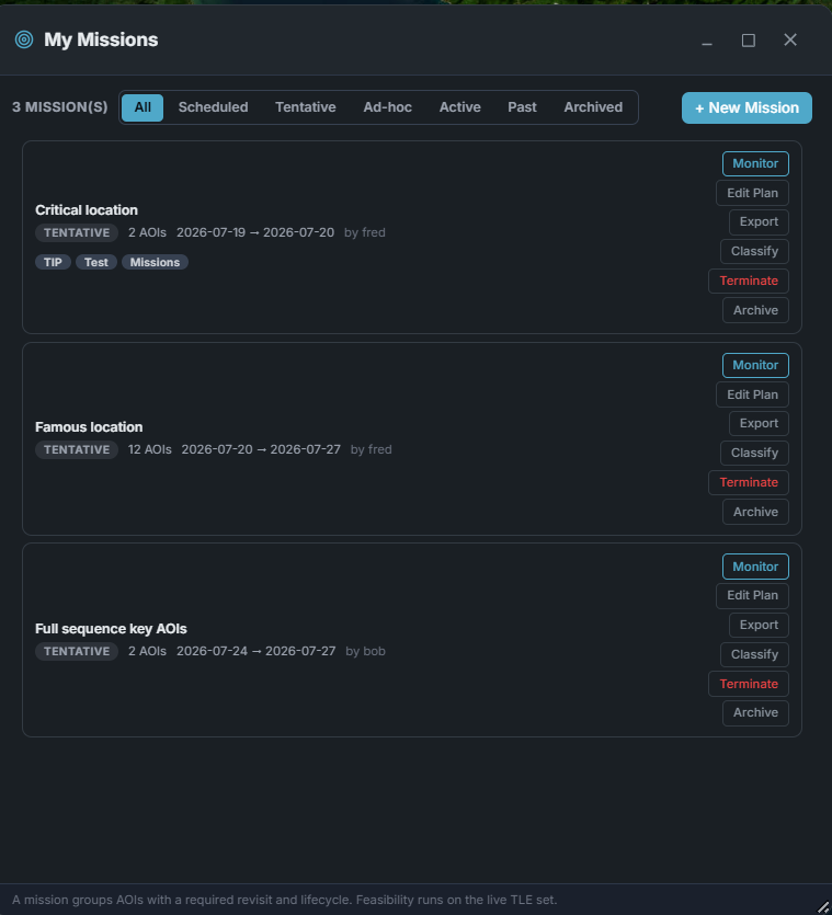
Mission library · lifecycle, tags, per-mission actions
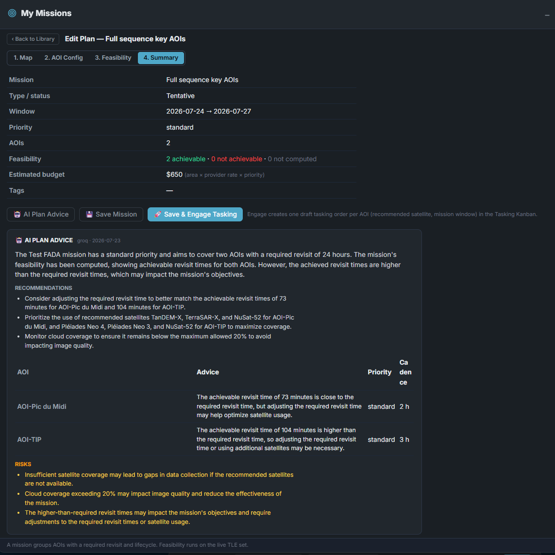
Feasibility summary · AI plan advisory with risks
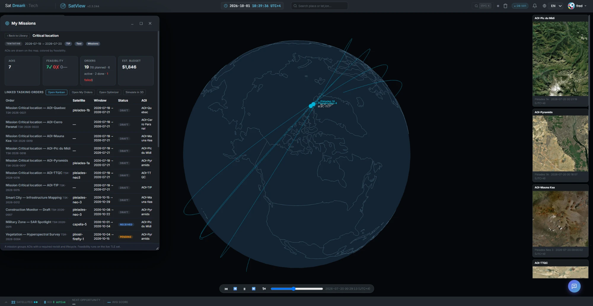
Simulate in 3D · onboard camera captures as each AOI's pass window is entered
Connectors
Each connector handles authentication, catalog search and ordering. Credentials are stored AES-256 encrypted per team, with a connection test and a health cache.
| Provider | Sensors | Capability |
|---|---|---|
| Airbus Defence & Space | Pléiades, SPOT — optical | Archive search · direct tasking |
| Maxar Technologies | WorldView — optical | Archive search · direct tasking |
| Planet Labs | Optical, daily revisit | Archive search · direct tasking |
| Capella Space | SAR | Archive search · direct tasking |
| Satellogic | Optical, multispectral | Archive search · direct tasking |
| Umbra | SAR — 0.16 m | Archive search |
| ICEYE | SAR | Archive search |
| BlackSky | Optical — 0.35 m | Archive search |
| UP42 | Aggregator, multi-sensor | Archive search |
| Copernicus / Sentinel | Optical, SAR — open data | Archive search · free |
Delivery is the halfway point — SatView takes the scene through processing and AI analysis next.
Tell us about your mission — we will get back to you.